Jotunheimen isn’t a place I’d ever thought about until seeing the movie Thor.
There. I admitted it. Sometimes I need a little mindless entertainment. And Thor’s reference to Jotunheim, the home of the Frost Giants, made me wonder about its place in Norse mythology.
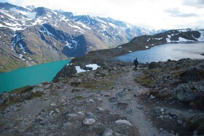
And that’s what led me to Norway and to Jotunheimen (or Land of the Giants) – to clinging to a steep ridge between two icy-cold lakes fed by snowmelt. Earlier today, sleet and rain pelted me. Powerful winds buffeted me. I sawed through all my Rise energy bars.

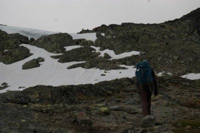
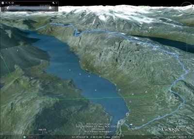
Jotunheimen is not the dark, bleak land of Thor’s foes. It is, though, as spectacular a landscape as I’ve ever seen and every bit worthy of a mention in Norse mythology. Our hike started just around 1 p.m. on the far east side of Gjende, the largest of the glacial lakes in sight. We parked our rented hybrid Toyota at Gjendesheim Turisthytte and loaded up. In our packs – rain gear, energy bars, water, sleeping bags, tent (just in case).
Our plan is to hike the Bessegen route. This will take us to a maximum elevation of about 5,725 feet. We’ll pass by Bessvatnet, a smaller lake 1,200 feet higher than Gjende. Our goal is to reach Memurubu, a tourist hut about 9 miles away. In this case, “tourist hut” is a misnomer. It’s a rather nice back-country hotel. The next day, we’ll take a boat down Gjende back to Gjendesheim.

We have the route virtually to ourselves for the first 2 hours or so. Then we start running into people who started their day at Memurubu; many take the boat in the evening and hike back the next day.
The views of Jotenheimen are spectacular. And it spoils the rest of Norway for us. A few days later in Flam, we’ll be at a magnificent fjord. And we’ll shrug and say “Meh. It’s no Jotunheimen.” That’s how cool it is.
The hike itself starts with a rigorous climb. And there’s one ridge that tests my fear of heights. The exposure is sharp on either side – and we descend about 1,000 feet in about a half-mile. I’m hyper-aware of my backpack’s effect on my balance, and the way my gloves compromise my handholds. And shoving my huge Lowa boots into the available space” Also a chore. But I get down after using every part of me – buttcheeks included – to clutch the rocks.

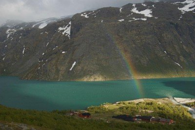
It takes a third and fourth wind to get me to the descent into Memurubu. As we drop lower, a rainbow appears – ending right at the hut. And probably right to the table where I’ll find a plate of ham, mashed turnips, carrots, baked potatoes and gravy waiting to refuel me from the hike. The Middle America-ness of the meal reminds me that many northern Midwest settlers came from places like Norway. It’s an interesting thought that sticks with me through dessert – and into an uninterrupted slumber in a roomful of backpackers.
Watch my Facebook page for more photos of Jotunheimen and other places from my trip to Norway and Finland. And here’s a short video clip!

This post just might contain affiliate links. Fear not, they’re non-spammy and benign. Hey, I have to keep this thing running somehow!

